More about Ha Giang
Location and access from the regional hubs
About 300 kilometres north of Hanoi, Ha Giang city is the essential logistical starting point for exploring the region. From the capital there are daily sleeper buses or VIP limousines, a six- to seven-hour journey via the Noi Bai - Lao Cai motorway and then National Road 2. Once in the provincial capital, visitors take National Road 4C to drive the Dong Van and Meo Vac loop. These winding roads are mostly travelled by motorbike for experienced riders, or by private car with a driver. Allow at least three to four days to complete the whole circuit without rushing.
The ten major sites and must-see stops in Ha Giang
To structure your itinerary across the province, here are the ten most emblematic stops representing the local natural and cultural heritage:
1. The alpine panorama of the Ma Pi Leng Pass

Ma Pi Leng. Photo: VNA
Considered the most spectacular of the four great mountain passes of northern Vietnam, the Ma Pi Leng Pass winds for about twenty kilometres along National Road 4C, linking the towns of Dong Van and Meo Vac. Clinging to the cliff at more than 1,200 metres, this spectacular road - cut into the rock by hand in the 1960s by thousands of workers and volunteers from local minorities - offers a breathtaking view over an ocean of sharp limestone peaks. Along the way, several lay-bys and stone viewpoints let you stop safely to gaze into the dizzying void. The atmosphere changes by the hour: bathed in harsh light at midday, the road is often covered by a shifting sea of clouds early in the morning. A stop at the main viewpoint is a chance to warm up with local coffee or buckwheat tea while watching eagles soar above the geological faults.
2. The emerald waters of the Nho Que river and the Tu San gorge

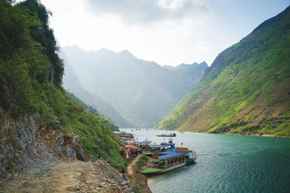
The Nho Que river. Photo: Hieu Dang
Regarded as the deepest in South-East Asia, with almost vertical rock walls rising nearly 1,000 metres, the Tu San gorge is one of the geopark's most impressive geological features. The Nho Que river, winding along the canyon floor with its brilliant jade-green waters, is reached by an extremely twisting side road that descends from the Ma Pi Leng Pass to the Ta Lang landing stage. There, traditional iron motorboats or shared kayaks take you on a trip of about an hour and a half on the water. As the boat moves deeper between the grey stone walls, the temperature drops sharply and the silence of the gorge is broken only by the lapping of the current and the sound of small waterfalls plunging straight from the cliffs. It is strongly advised to book your trip early in the morning to avoid crowds and enjoy the best light on the water.
3. The unique geology of the Dong Van limestone plateau

The Suoi Thau grassland turns purple with buckwheat flowers. Photo: Tran Linh
A member of the UNESCO Global Geoparks Network since 2010, the Dong Van limestone plateau covers more than 2,300 square kilometres and brings together rock formations shaped over more than 500 million years. This striking mineral landscape, often called a "stone desert", is characterised by vast fields of black limestone blocks eroded by the climate and monsoon rains. The interest of a stop on the plateau lies in observing how people have adapted to this hostile environment: Mong communities grow maize by planting directly in the soil collected in the smallest rock hollows (hoc da), protected by carefully built dry-stone walls without mortar. Walking the paths between the perched hamlets shows the resilience of the inhabitants and reveals a high-mountain landscape unique in Asia.
4. The heritage architecture of the Mong king's palace (Dinh ho Vuong)

The king's residence, covering more than 1,000 square metres, is a national historic monument (architectural and artistic heritage). Photo: Hachi8
Nestled in the heart of the Sa Phin valley, about 15 kilometres before Dong Van town, this fortified lordly complex was built at the end of the 19th century as the home of Vuong Duc Chinh, the influential leader of the Mong community who then controlled the opium trade and the border trade routes. Protected by a screen of century-old cypresses and enclosed by a double wall of dressed stone with a walkway on top, the palace spreads over three successive inner courtyards. Its architecture remarkably combines traditional Mong craftsmanship (carved pillars, yin-yang tiled roofs), Qing-dynasty Chinese defensive structures and European-inspired woodwork details. The guided tour of the living quarters, ammunition stores and kitchens helps you understand the complex geopolitical context of this border region in the early 20th century.
5. The national symbol of the Lung Cu flag tower

Lung Cu flagpole. Photo: The Sun Tourist
Perched on top of Mount Rong (Dragon Mountain) at more than 1,400 metres, the Lung Cu flag tower stands barely three kilometres from the Chinese border, overlooking the country's northernmost commune. This 33-metre octagonal stone tower, inspired by the flag tower of the Hanoi citadel, flies a 54-square-metre national flag, an area symbolising the 54 ethnic groups that make up the Vietnamese nation. To reach the top, you first climb 839 stone steps up the mountainside, then a spiral staircase inside the tower itself. From the upper viewing platform, visitors enjoy a superb 360-degree view over the two legendary round ponds below, the patchwork of terraced rice fields and the mountain ranges stretching endlessly on the Chinese side.
6. The age-old bustle of Dong Van old quarter and market

Dong Van market. Photo: Hoang Giang
Set in a valley ringed by rocky peaks, Dong Van old quarter preserves a group of traditional houses built in the early 20th century. These two-storey houses show typical highland architecture: thick rammed-earth walls painted yellow, solid wooden frames and yin-yang tiled roofs weathered by time. The heart of the town really comes alive at the Sunday market. From Saturday evening and then at dawn on Sunday, Mong, Dao, Lo Lo and Tay people come down from the surrounding mountains wearing their finest traditional costumes. It is an authentic place of exchange where people sell livestock, medicinal herbs or embroidered fabrics, but also share a steaming bowl of thang co or a glass of corn liquor in a festive, friendly atmosphere.
7. The curved shapes of the Quan Ba twin hills (Nui Doi)
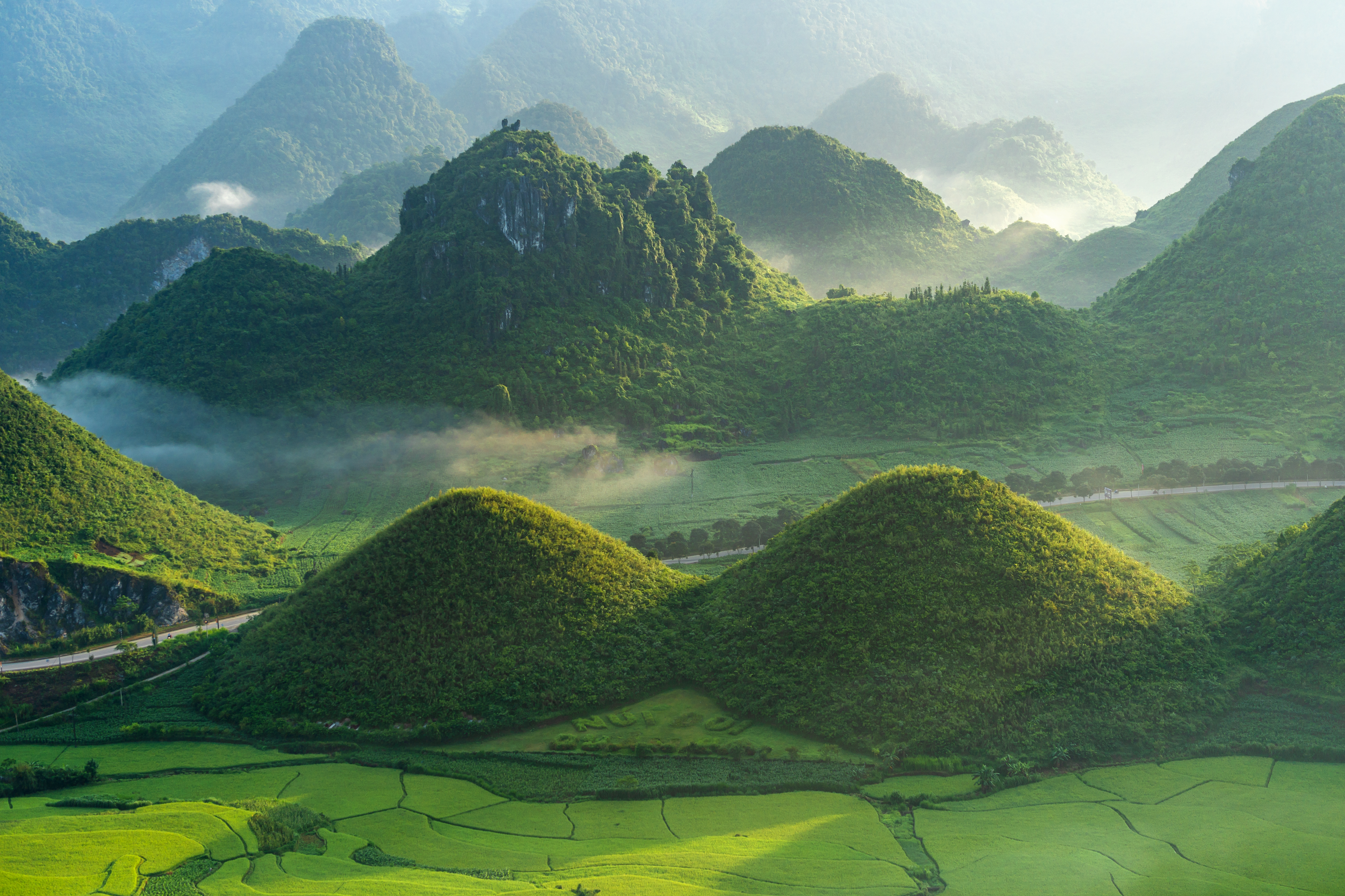
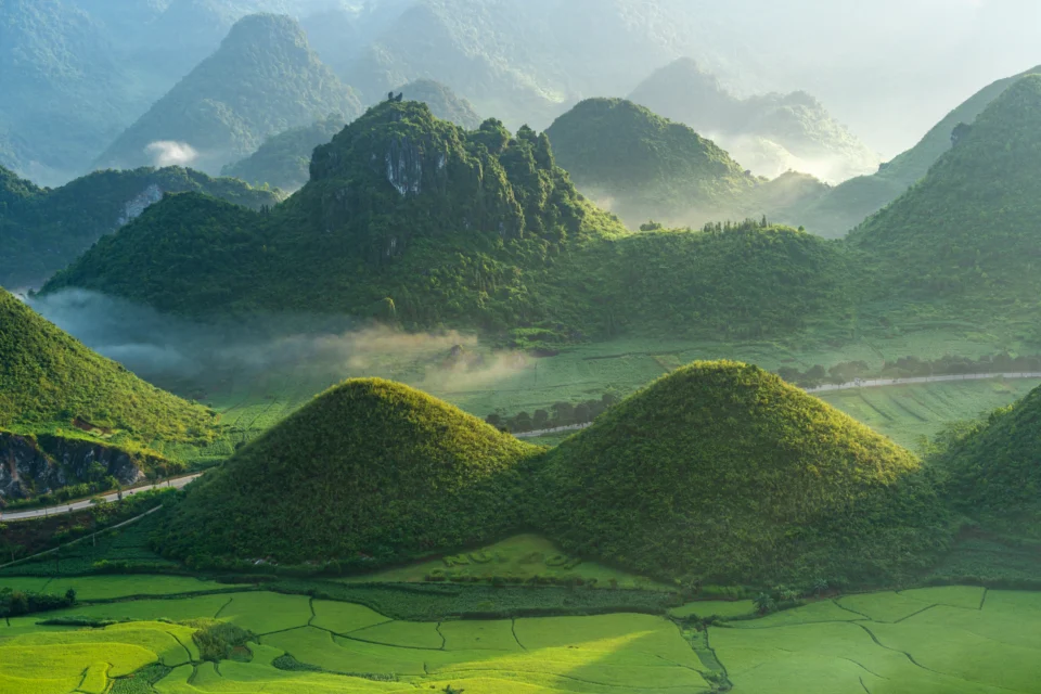
Two limestone hills. Photo: VNA
About forty kilometres north of Ha Giang city, just after the famous "Gate of Heaven" (Cong Troi), the road reveals a spectacular view of the Tam Son valley. Two perfectly conical, symmetrical limestone hills rise in the middle of green rice fields. Known as the Quan Ba twin hills or the "Fairy" twin hills (Nui Doi), these unique formations are linked to a touching Mong legend about a mother's devotion. A viewpoint along the main road lets you stop and admire this harmonious landscape, whose colours change with the seasons - from tender green at rice planting to golden yellow at harvest - framed by the austere relief of the surrounding mountains.
8. The winding route of the Tham Ma Pass

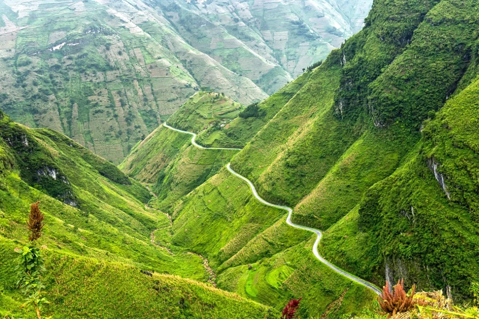
The winding road of the Tham Ma Pass. Photo: Quang Nguyen Vinh
On National Road 4C to Dong Van, the Tham Ma Pass is one of the most iconic and photogenic stretches of road in the North. This passage of very tight hairpin bends owes its name ("horse-testing pass") to a local tradition: packhorses laden with goods were once made to climb it to test their strength and endurance. Today, a stop at the top of the climb offers a striking panoramic view of the perfect "S" curves drawn by the road below. It is also a favourite place to meet children from local minorities selling crowns of fresh wild flowers, making it a lively, colourful stop before heading deeper into the limestone plateau.
9. Cultural immersion in the traditional Black Lo Lo village of Lo Lo Chai

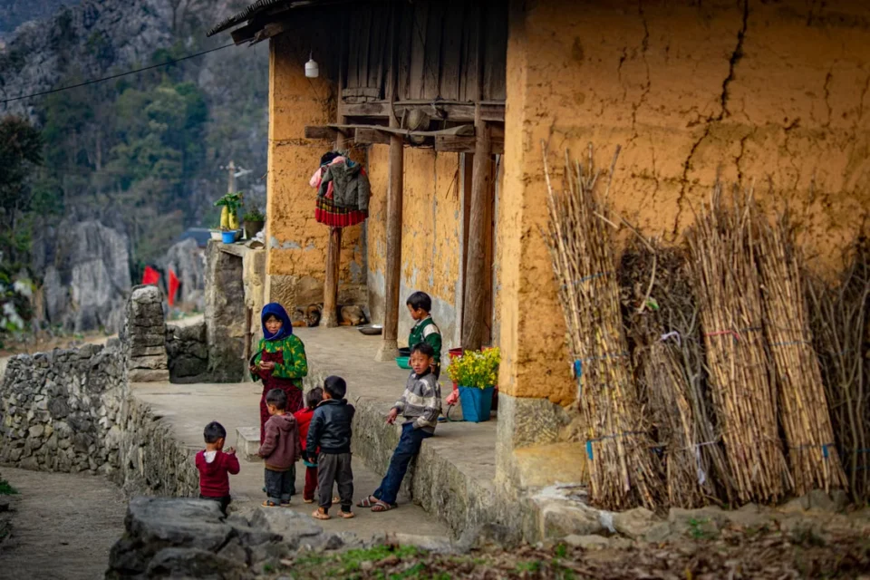
Children playing in Lo Lo Chai village. Photo: Vietnam Hidden Light
Nestled at the foot of Mount Rong, just a few hundred metres from the Lung Cu flag tower, Lo Lo Chai village is home to the Black Lo Lo, one of Vietnam's smallest ethnic minorities. The village stands out for the exceptional preservation of its architectural and cultural heritage: rammed-earth houses with tiled roofs are enclosed by carefully built dry-stone walls. Strolling through its quiet lanes, you can watch the women meticulously making their traditional costumes with complex geometric patterns pieced together from coloured fabrics. The village's gentle move into homestay tourism (homestay) lets visitors stop for an authentic coffee or share a traditional family meal.
10. The spectacular rice terraces of Hoang Su Phi

Hoang Su Phi. Photo: Quang Nguyen Vinh
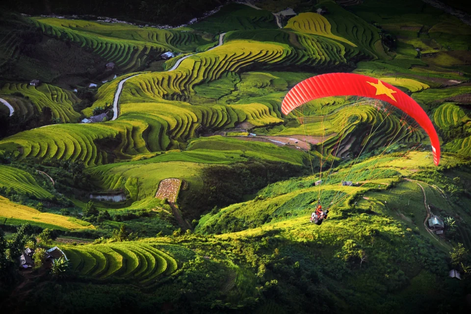
Located in the west of Ha Giang province, away from the mineral limestone plateau, Hoang Su Phi district offers a completely different landscape shaped by water and human labour. Listed as national heritage, its rice terraces cover thousands of hectares, climbing from the valley floors to the mountain tops over impressive gradients. Carved over generations by the La Chi, Dao, Tay and Nung peoples, these terraces follow the curves of the relief perfectly. The visit is especially spectacular during the "mirror season" (May-June), when the paddies fill with water and reflect the sky, or the "golden season" (September-October), when the mountains turn a brilliant yellow just before the harvest.
Climate and seasons for a mountain stay
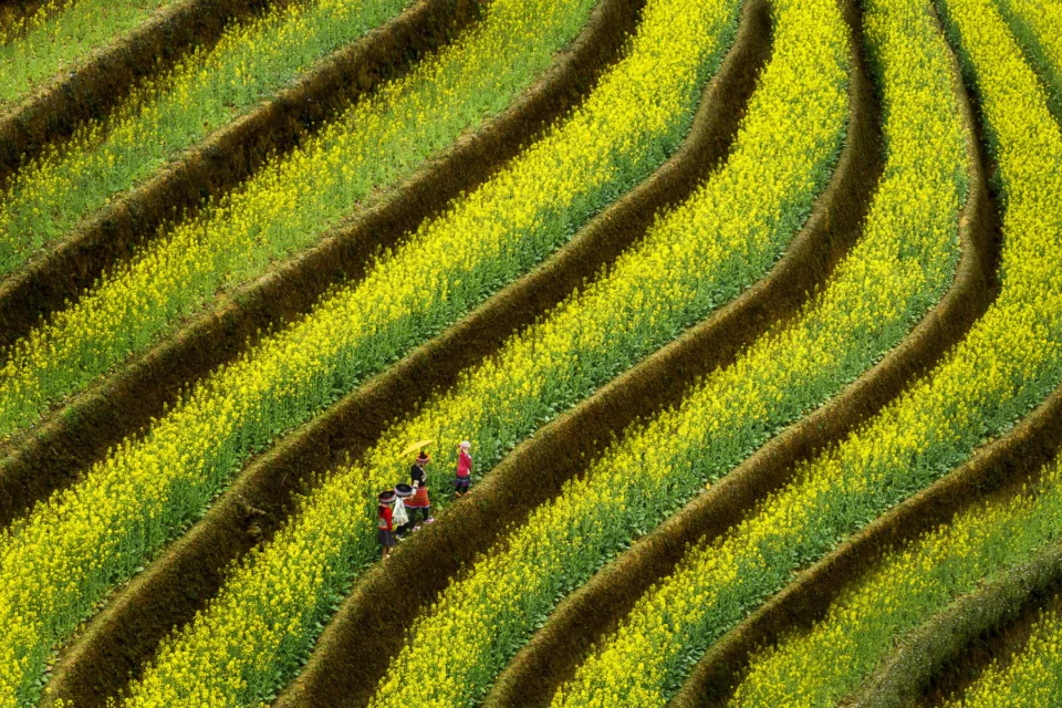
Ha Giang's climate varies greatly with altitude and season. The most favourable period runs from September to April. Autumn (September and October) is rice harvest time and brings golden landscapes to Hoang Su Phi. Between October and December, the hills are covered with buckwheat flowers (tam giac mach), attracting many visitors. Winter (January and February) brings sharp cold and dense mist, while spring sees wild peach and plum trees in bloom. The rainy season, from May to August, cools the air but increases the risk of landslides on mountain roads.
The preserved balance of an exceptional frontier
Ha Giang's value lies in a remarkable balance between the harshness of its mineral relief and the vitality of its rural traditions. Its relatively difficult access still spares the region from the excesses of mass tourism, guaranteeing visitors a genuine immersion. It remains an essential stop for anyone wishing to grasp the geological grandeur and cultural richness of northern Vietnam.